Description of Showcase
This page presents selected GIS analyses completed in ArcGIS Pro, emphasizing raster analysis, spatial pattern recognition, and quantitative spatial reasoning. Projects are summarized below with key methods and outcomes.
Temple University Ambler Campus: Supervised Change Detection Pre and Post Tornado
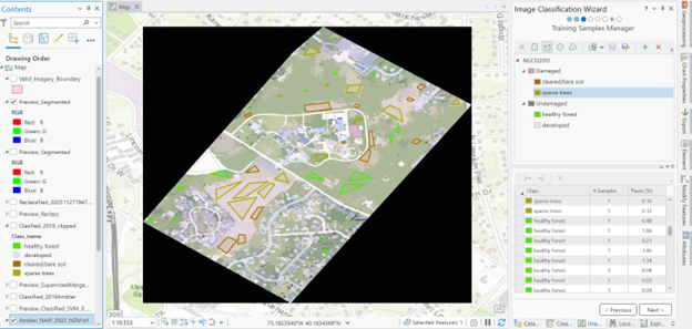
Overview: Delivered as a final project for MUSA 6320: Modeling Geographic Space in Fall 2025, this analysis employed supervised classification techniques to detect land cover changes on Temple University’s Ambler Campus before and after a tornado event in September 2021. Using high-resolution satellite imagery from 2020 and 2022, the project attempted to identify areas of significant alteration in vegetation, built structures, and impervious surfaces.
Key Outputs